


Google Maps/StreetView has taken several rides through Syracuse snapping pictures of our region since 2007. With the release of a “Time Machine” feature added to the service in the past year, we are able to identify and compare local areas that have seen some big changes between 2007 and 2014.
From the cleanup of Onondaga Lake to various downtown developments, we are in the midst of a noticeable “boom” in CNY. While every development project is not included here, we found some of the notable examples that help define our region’s continued improvements.
Look at the before-and-after Google Street View images below:
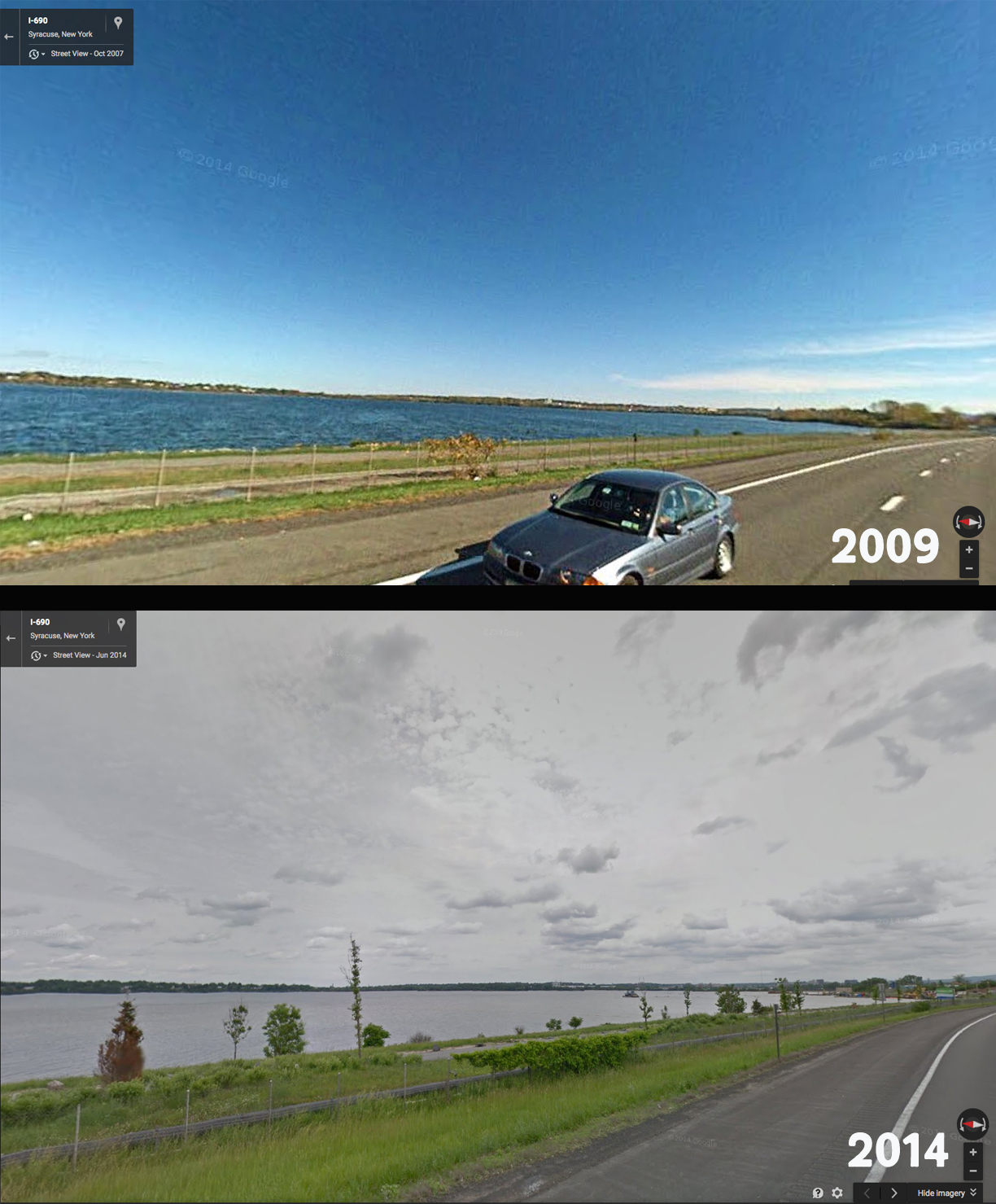
This image may not show many drastic changes, but Honeywell recently announced the completion of dredging at Onondaga Lake. Couple this with the West Shore Trail and the coming Amphitheater, Onondaga Lake and it’s shoreline seems be on the rebound.
Google Maps Street View
© 2015 Google
While it didn’t turn out exactly how we remember the early renderings, Destiny USA saw a major facelift with the addition of “The Canyon.”
Google Maps Street View
© 2015 Google
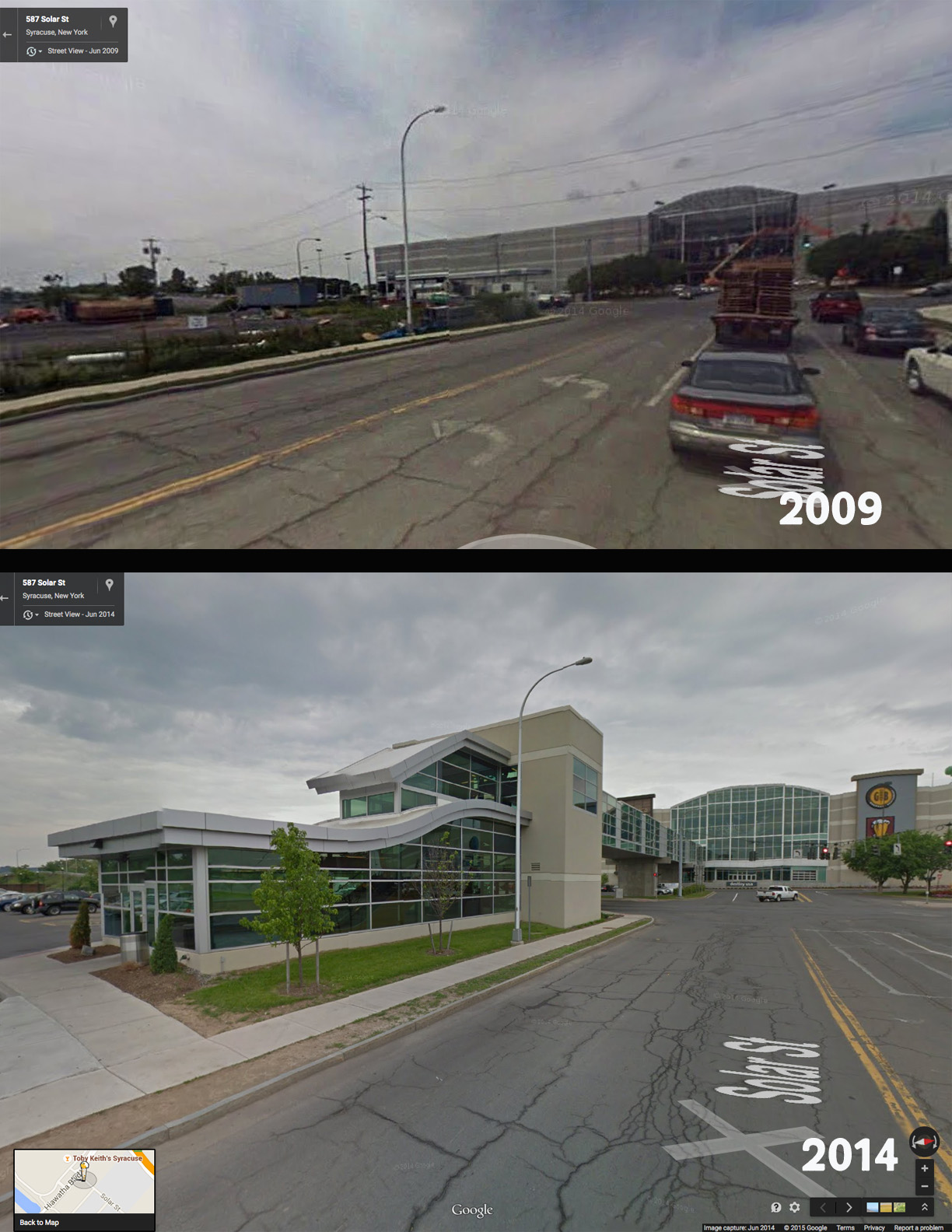
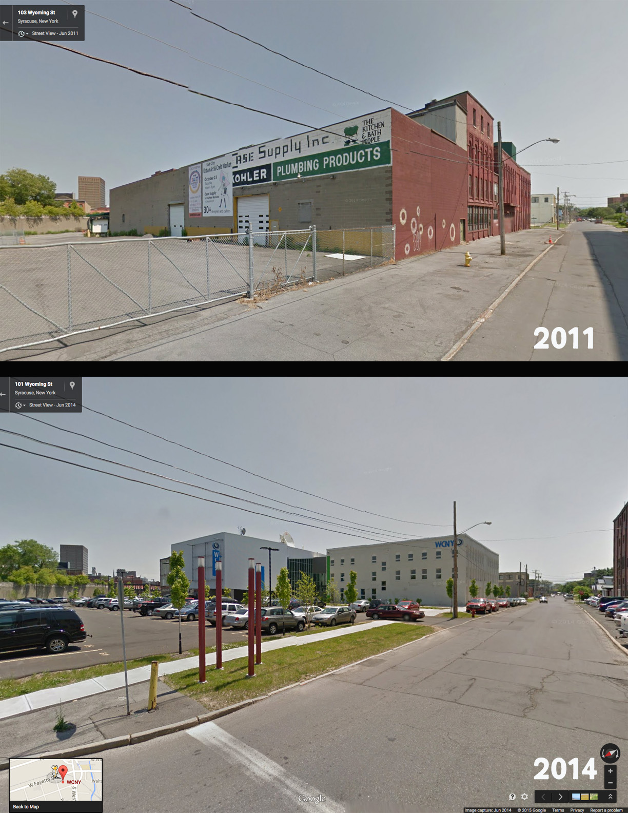
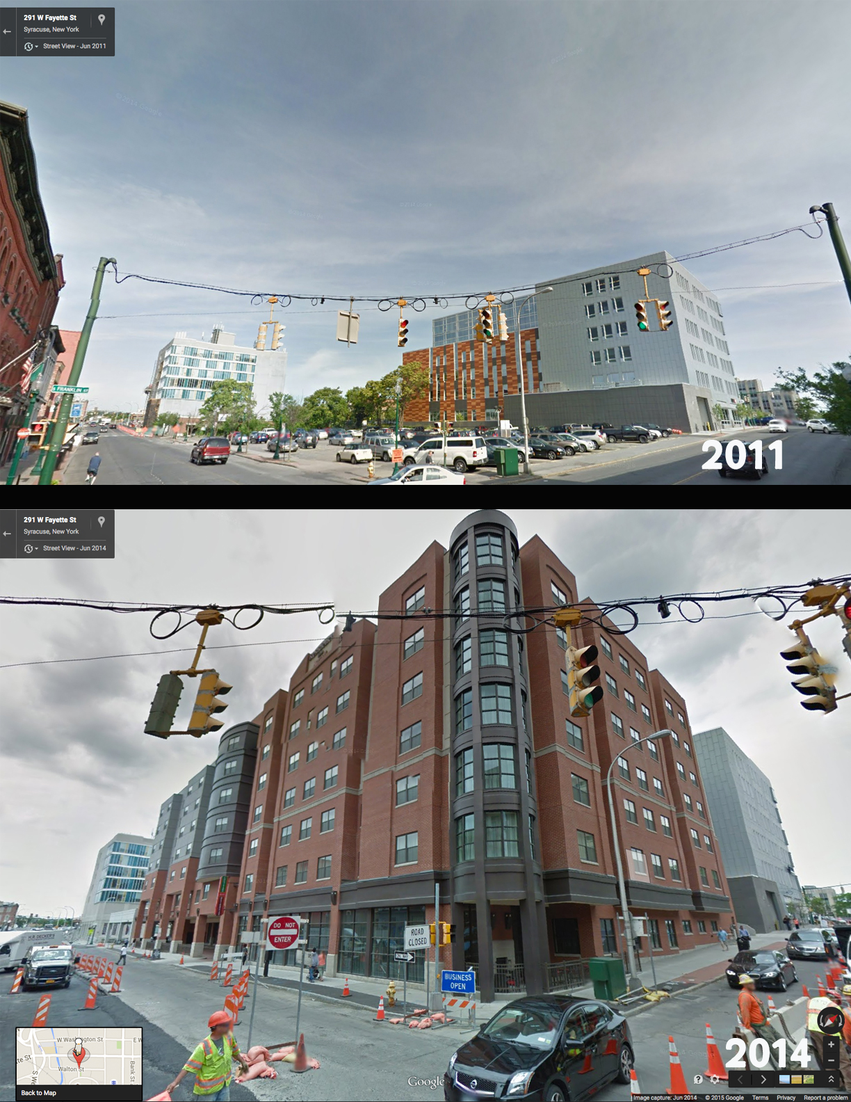
A quick trip to the Near West Side (SALT District) shows the former Case Supply building transformed into the new WCNY facility.
Google Maps Street View
© 2015 Google
Down the street, Armory Square has seen some welcome additions, too.
Google Maps Street View
© 2015 Google
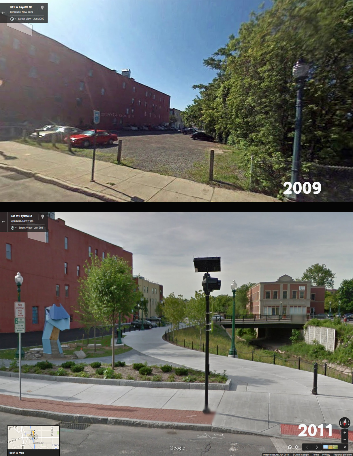
Don’t forget the Onondaga Creekwalk – a unique glimpse of the city winding alongside Onondaga Creek. Stop and say hello to “Walt” the Creek Monster, created by local artist Brendan Rose, as you stroll, bike or jog by.
Google Maps Street View
© 2015 Google
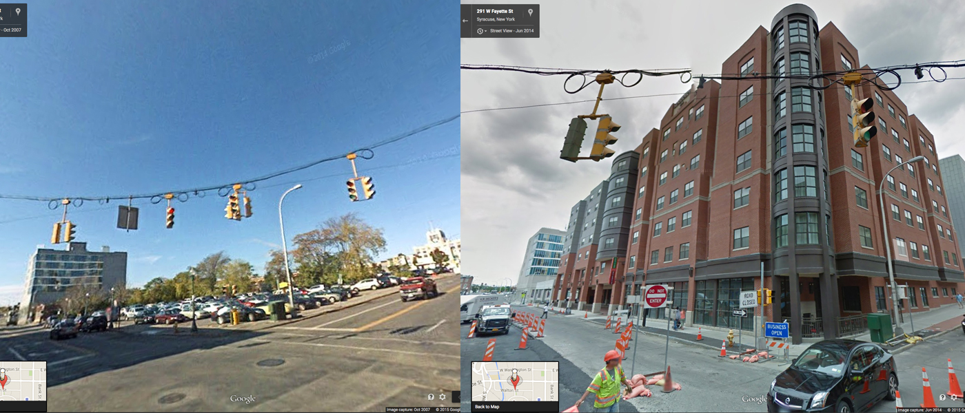
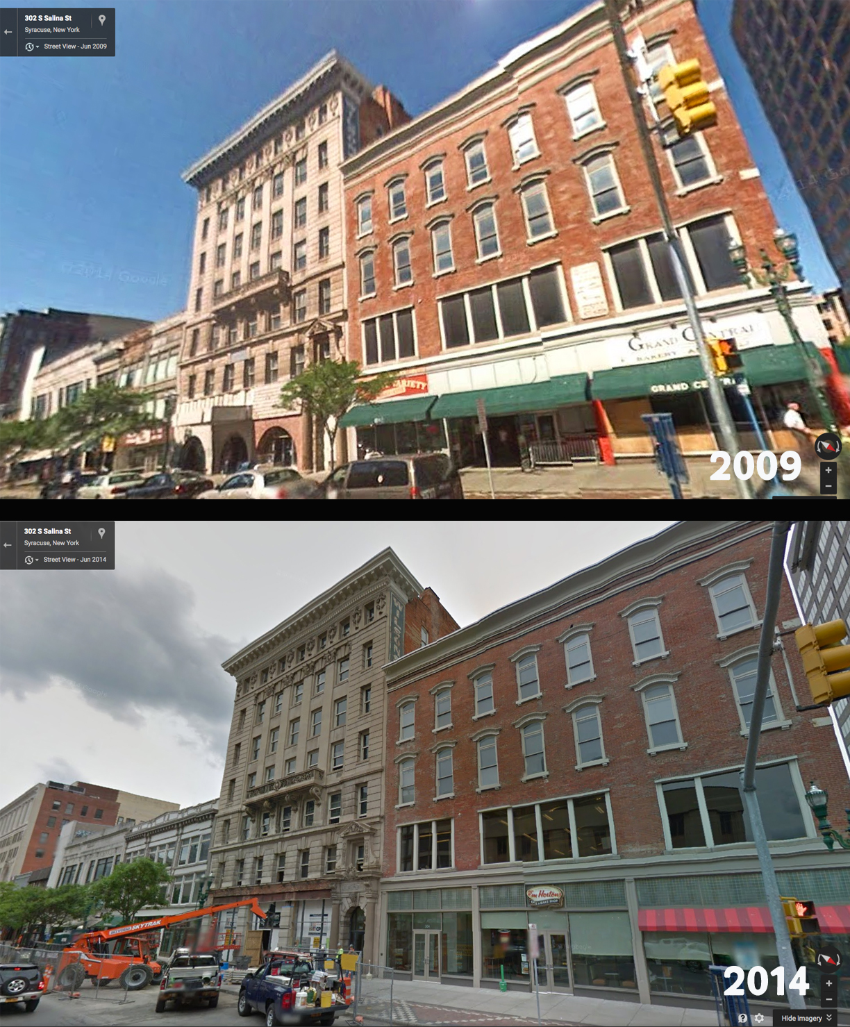
The Pike Block, located in the heart of downtown, is now home to new businesses, apartments and retail spaces.
Google Maps Street View
© 2015 Google
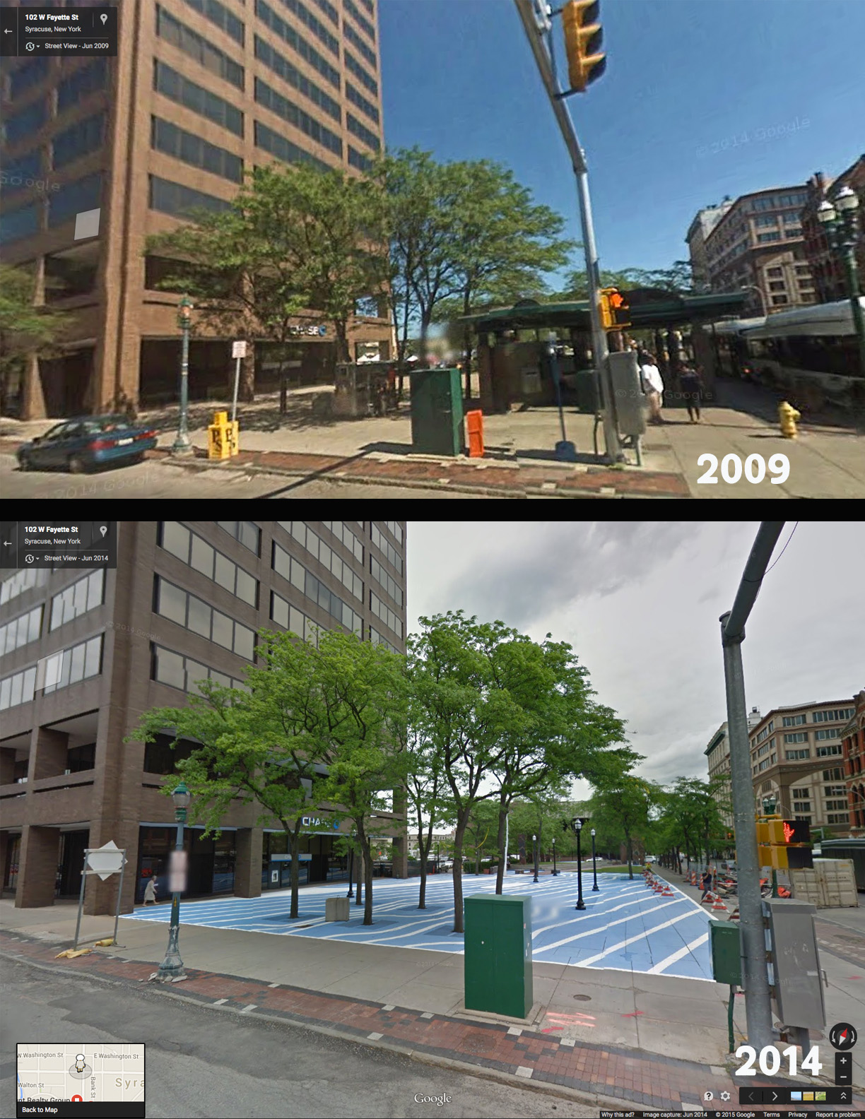
Across the street from the Pike Block, Perseverance Park is currently undergoing a (re)design process. Pictured below is a temporary public art project titled “Flowscape,” by Jason Evans.
Google Maps Street View
© 2015 Google
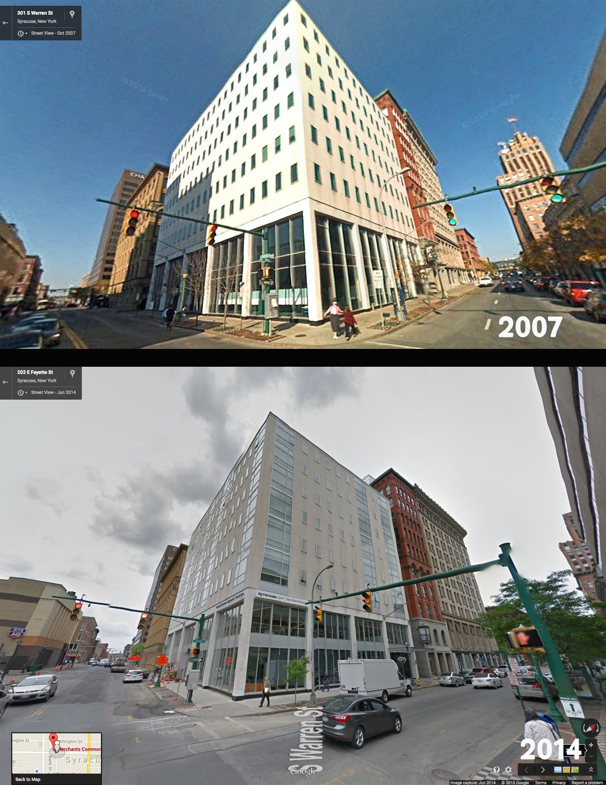
One block further into downtown Syracuse is the refurbished Merchant’s Commons building – which includes apartments, retail spaces and a new home for some of Syracuse’s local journalists. The rooftop view is noteworthy.
Google Maps Street View
© 2015 Google
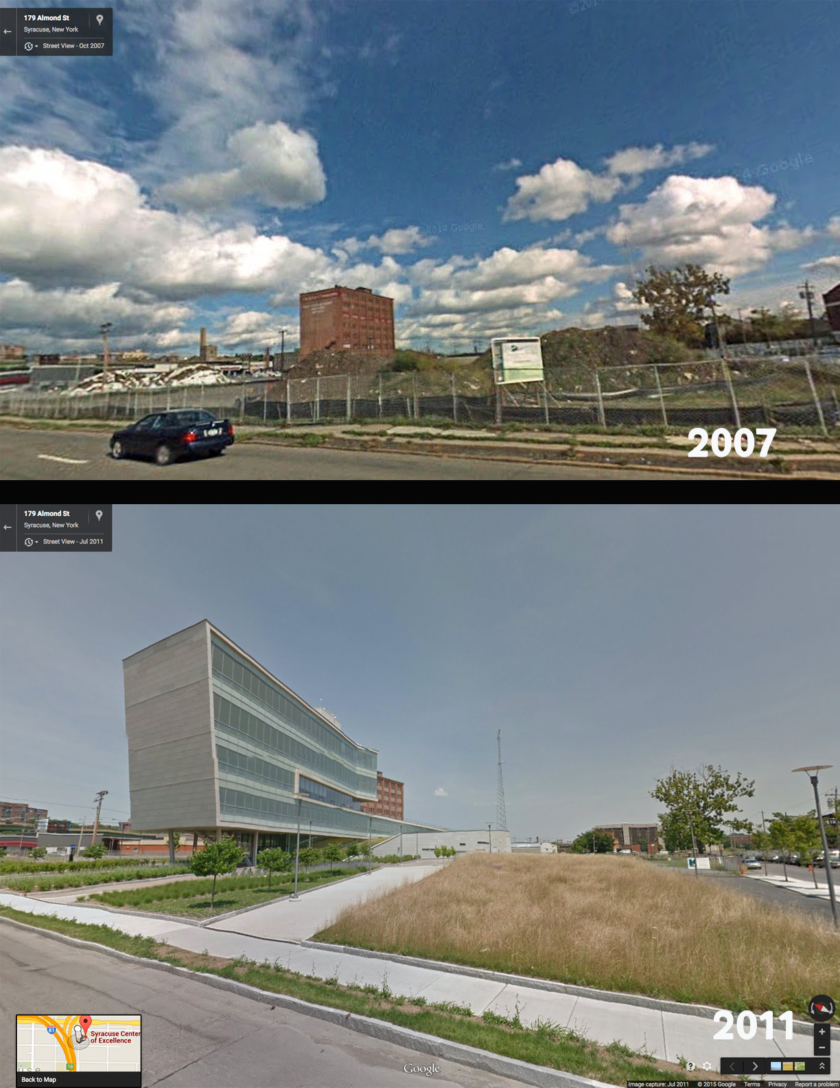
On the east side of downtown, recent history shows the addition of the Center of Excellence.
Google Maps Street View
© 2015 Google
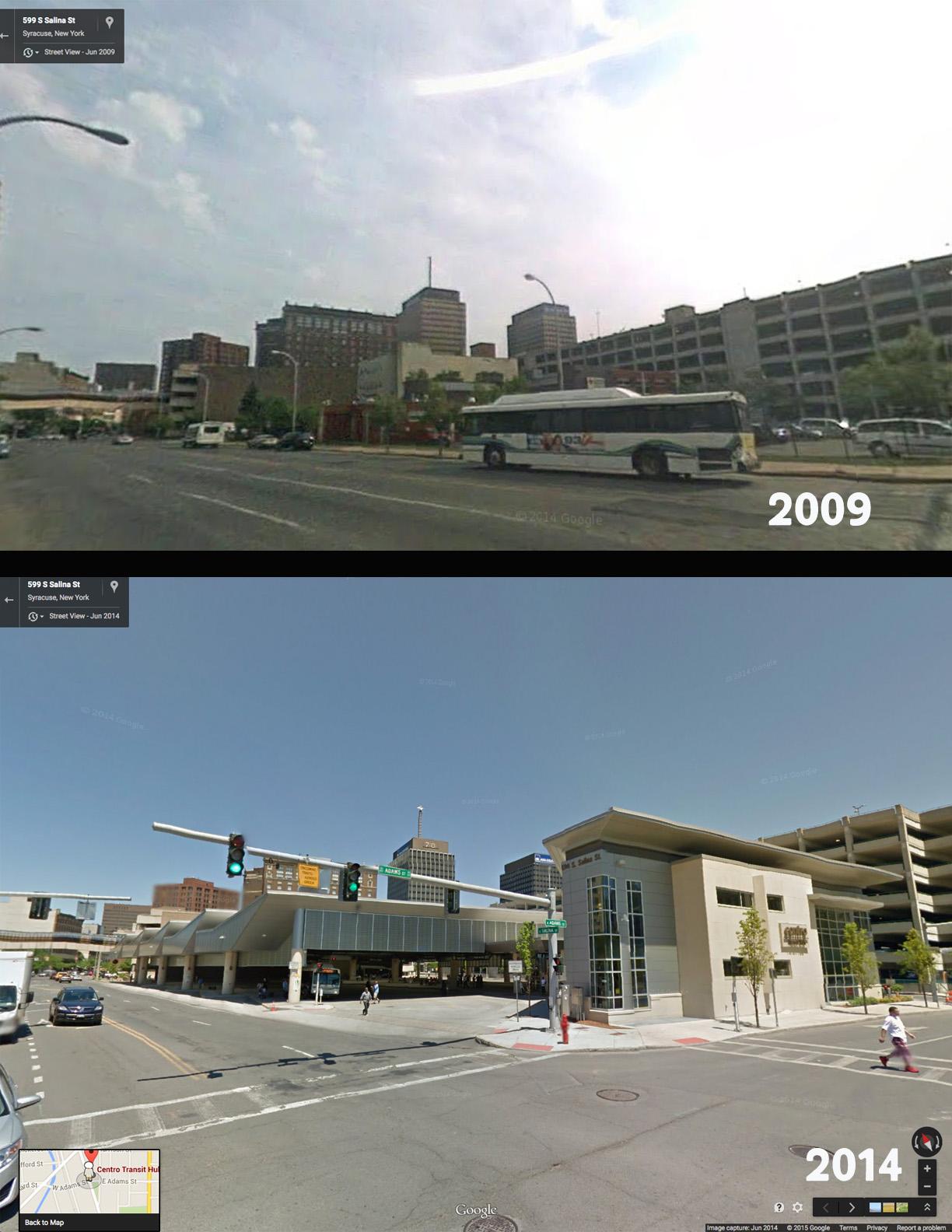
Here is the new Centro Transit Hub.
Google Maps Street View
© 2015 Google
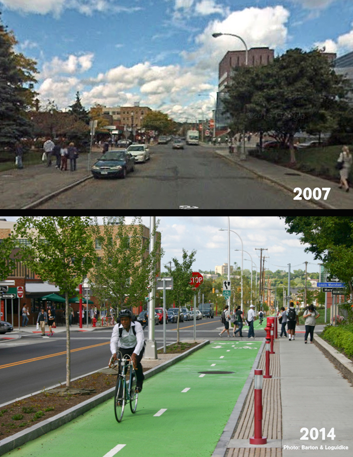
While Google Maps hasn’t caught up with all the developments in our region, the Connective Corridor continues to turn regular roads into smart streets. Read about the Connective Corridor public art projects HERE.
Google Maps Street View
© 2015 Google
Finally, even the Syracuse New Times building (home of your favorite alternative newsweekly, Absolutely George-Ous Salon and Spinnaker Custom Products) has seen some upgrades to our building and neighborhood in the past few years.
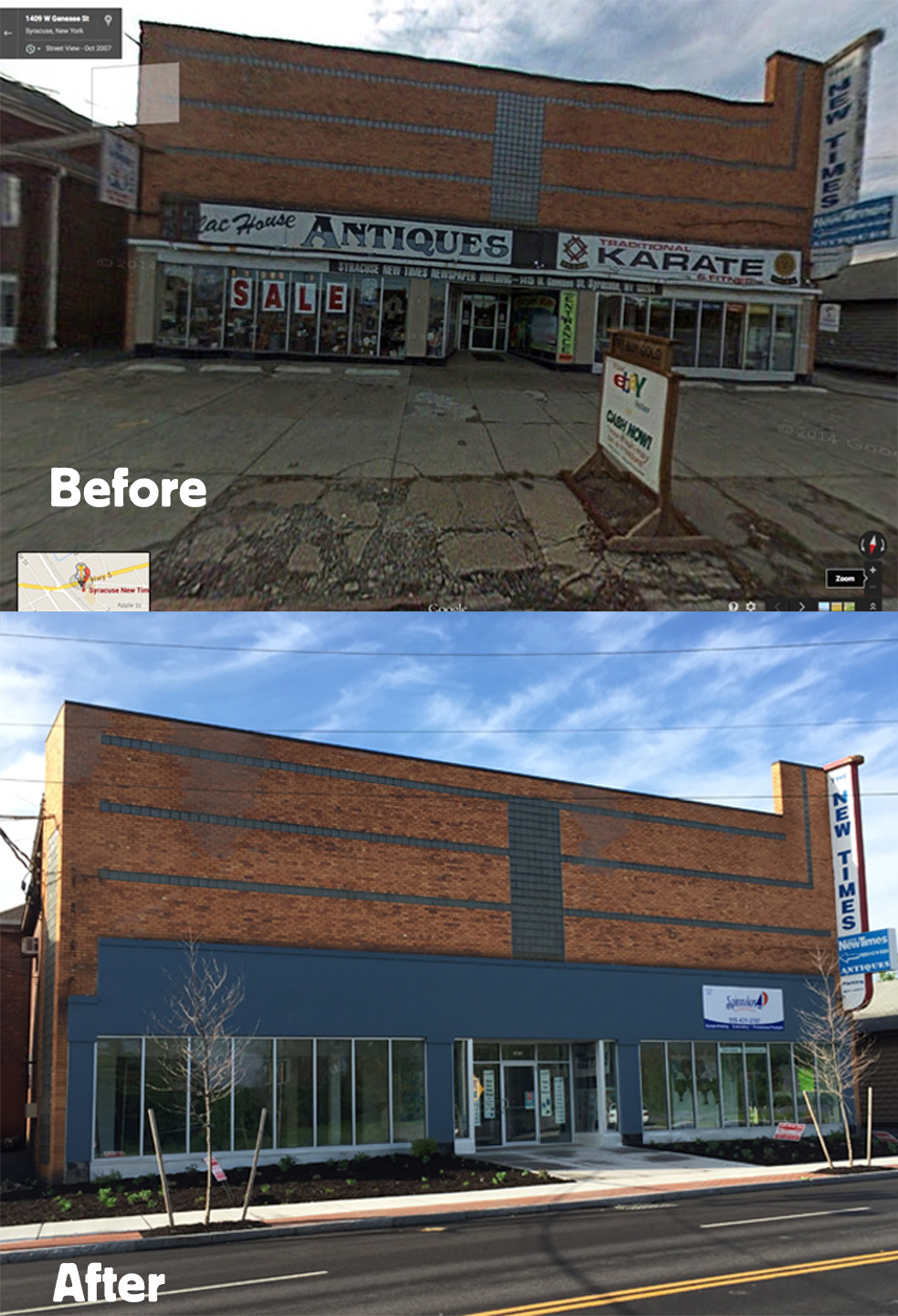
Google Maps Street View
© 2015 Google
Click your way through Syracuse via Google Maps/Street View – HERE